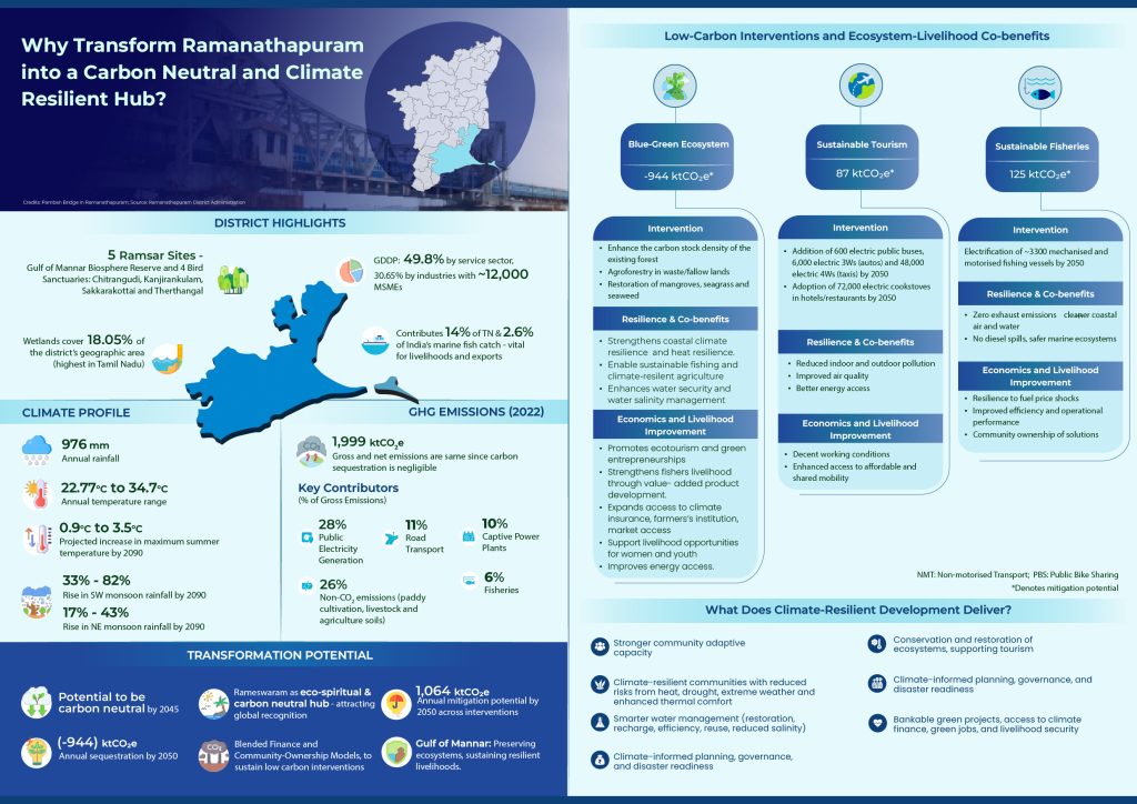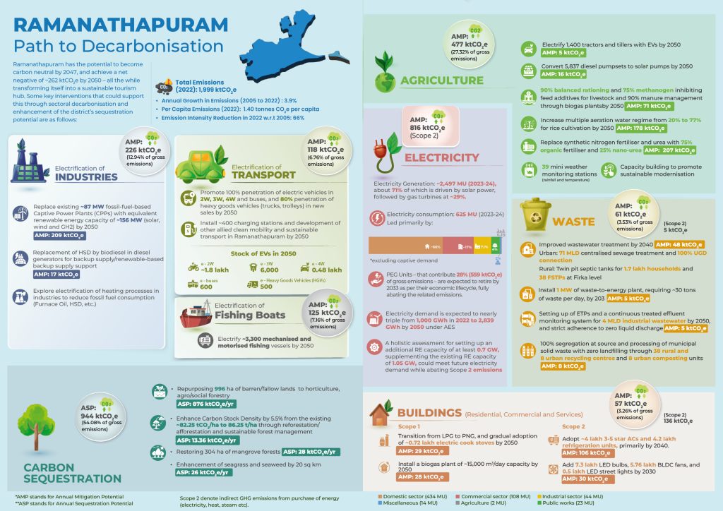

Ramanathapuram, a coastal district in south-eastern Tamil Nadu, spans 4,069 sq. km and is home to about 13.5 lakh people (Census 2011). Defined by its 276 km coastline, vibrant fishing economy, heritage and pilgrimage tourism, and rich coastal and marine biodiversity—including five Ramsar sites—the district’s geographical diversity supports a mix of livelihoods across marine fisheries, agriculture, MSMEs, and renewable energy, with solar capacity exceeding 1.1 GW. These same landscapes, from sandy plains to sensitive coastal ecosystems, also shape the district’s exposure to climate risks.
As part of the Gulf of Mannar Biosphere Reserve, Ramanathapuram hosts coral reefs, seagrass meadows, and diverse marine life that sustain coastal livelihoods, act as significant carbon sinks, and provide natural protection against erosion and extreme weather. The district’s dry tropical climate is marked by rising temperatures and increasingly erratic rainfall, with historical data and RCP8.5 projections indicating temperature increases up to 3.5°C and monsoonal rainfall growth of 17–82% by 2090. These changes heighten vulnerabilities to heat stress and flooding, particularly in low-lying and coastal areas.